
Geospatial data is no longer limited to maps and traditional GIS systems. Today, Python provides a bridge connecting GIS expertise with the power of data science. Professionals who understand spatial data and can manipulate it programmatically are in high demand. The path from GIS to data science requires not just learning new Python libraries, but also understanding spatial thinking, analytics, and automation.
This article presents nine essential books that will strengthen your Python geospatial skills and guide you in becoming a full-fledged GIS data scientist. Each book is carefully selected to cover theory, practical exercises, automation, and advanced spatial analysis, giving you a clear roadmap to excel in GIS with Python.
1. Python Geospatial Analysis Cookbook by Michael Diener
This book is perfect for practitioners looking for a hands-on approach. It offers a variety of practical recipes that cover data formats, shapefiles, raster data, coordinate reference systems, and common spatial operations. Each chapter focuses on solving real-world GIS problems while teaching Python techniques. You will learn how to read, process, and analyze spatial datasets, automate repetitive tasks, and visualize results using popular libraries like Geopandas and Matplotlib. The step-by-step approach allows GIS analysts transitioning from desktop software to gain confidence in coding efficiently while seeing immediate results. This makes it an ideal starting point for anyone wanting to build a strong foundation in Python geospatial analysis.
2. Learning Geospatial Analysis with Python by Joel Lawhead
This book is a comprehensive guide for beginners and intermediate GIS professionals. It starts by explaining the basic principles of Geographic Information Systems, including projections, coordinate systems, and spatial data types. Then, it introduces Python programming for spatial analysis. You will explore automation of GIS tasks using libraries like Geopandas, Rasterio, Shapely, and Fiona. The book provides exercises to manipulate vector and raster datasets, perform spatial joins, and create maps programmatically. The clear connection between GIS theory and Python implementation helps build a solid understanding for anyone aiming to automate GIS workflows and prepare for data science applications in spatial contexts.
3. Mastering Geospatial Analysis with Python by Silas Toms and Paul Crickard
This advanced book is for those who already understand the basics of Python GIS. It delves into network analysis, spatial databases, and the development of web-based geospatial applications using Flask and Leaflet. You will learn to integrate Python scripts with PostGIS databases, perform advanced spatial queries, and develop interactive spatial dashboards. The book emphasizes combining Python programming skills with GIS knowledge to tackle complex problems in transportation, urban planning, and environmental modeling. It encourages readers to think like spatial data scientists, moving from simple map creation to data-driven decision making using Python as the main tool.
4. Geoprocessing with Python by Chris Garrard
Focused on automation, this book shows how to streamline GIS workflows both inside traditional desktop GIS environments and in open-source Python ecosystems. It explains ARCPY, OGR, Shapely, and Fiona in depth, teaching readers to automate repetitive tasks like geocoding, spatial joins, and map production. You will gain practical skills for cleaning and transforming large spatial datasets, preparing them for analysis or visualization. It is particularly useful for GIS professionals who want to reduce manual work and integrate Python into everyday GIS operations, saving time and increasing accuracy in projects.
5. Python for Geospatial Data Analysis by Bonny P McClain
This book combines spatial statistics with data science thinking. It moves beyond map creation to predictive modeling and data-driven insights using libraries like Pandas, Scikit Learn, and Geopandas. You will learn to calculate spatial autocorrelation, perform clustering and regression on geospatial datasets, and integrate spatial variables into machine learning models. It is ideal for GIS analysts who want to apply analytical methods to uncover patterns, trends, and relationships in spatial data, making it relevant for urban planning, environmental studies, and business analytics projects where Python provides an edge in processing and analysis.
6. Automating GIS Processes by Henrikki Tenkanen and Vuokko Heikinheimo
Developed by university researchers, this open textbook is freely accessible and teaches automated workflows in GIS using Python. It covers reading, writing, and visualizing spatial data, performing basic and advanced analysis, and writing reusable scripts for reproducible research. You will learn best practices for structuring code, managing projects, and documenting workflows, which is essential for GIS professionals entering the data science world.
7. Geospatial Data Science with Python by Bonny P McClain
This newer release expands on her previous work by introducing advanced techniques like geocoding, clustering, and spatial machine learning. It brings together theory and applied projects that resemble real data science pipelines, making it an excellent progression once you have mastered the basics. You will learn to perform spatial clustering to detect hotspots, apply machine learning models to geospatial data, and integrate Python visualization tools to create interactive and informative maps. The book strengthens both analytical thinking and coding skills, giving GIS analysts practical experience to operate at the intersection of GIS and data science.
8. Practical GIS by Gábor Szabó
This book guides you through open-source GIS ecosystems like QGIS and PostGIS while integrating them with Python automation. It is designed for professionals who want to bridge desktop GIS experience with backend database-driven systems. You will learn to connect Python scripts with spatial databases, automate data imports and exports, perform spatial queries, and develop workflows that combine GIS tools with programmatic solutions, enhancing productivity and ensuring reproducibility in GIS projects.
9. Python Geospatial Development by Erik Westra
One of the earliest yet still relevant references on building complete geospatial applications. It walks you from handling coordinates and projections to creating interactive maps and integrating them with web frameworks. You will learn how to develop end-to-end geospatial projects, acquire data, process it, visualize results, and deliver interactive mapping solutions. This book is ideal as a final step in your journey, consolidating Python skills and GIS knowledge to produce professional geospatial applications.
Conclusion
Moving from GIS to data science is more than learning new syntax. It is about changing how you think about data. Each of these ten books gives you not just tools, but ways of reasoning spatially, computationally, and statistically. By reading them and applying their lessons, you will transform from a map maker into a spatial data scientist capable of solving complex challenges with Python. The roadmap provided by these books ensures you grow from a GIS analyst to a Python-powered geospatial expert, ready to tackle any real-world spatial problem.
إتقان بايثون لنظم المعلومات الجغرافية: تسعة كتب أساسية يجب على كل محلل نظم معلومات جغرافية قراءتها
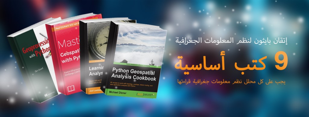
لم تعد البيانات الجغرافية المكانية مقتصرة على الخرائط وأنظمة المعلومات الجغرافية التقليدية، فاليوم تُوفر بايثون جسراً يربط بين خبرة نظم المعلومات الجغرافية وقوة علم البيانات، فهناك طلب كبير على المتخصصين الذين يفهمون البيانات المكانية ويستطيعون معالجتها برمجياً، إذ لا يتطلب الانتقال من نظم المعلومات الجغرافية إلى علم البيانات مجرد تعلم مكتبات بايثون جديدة بل يتطلب أيضاً فهم التفكير المكاني والتحليلات والأتمتة
تقدم هذه المقالة تسعة كتب أساسية تُعزز مهاراتك الجغرافية المكانية في بايثون وتُرشدك لتصبح عالم بيانات متخصصاً في نظم المعلومات الجغرافية، فقد تم اختيار كل كتاب بعناية ليغطي الجوانب النظرية والتمارين العملية والأتمتة والتحليل المكاني المتقدم مما يمنحك خارطة طريق واضحة للتفوق في نظم المعلومات الجغرافية باستخدام بايثون
1. Python Geospatial Analysis Cookbook by Michael Diener
هذا الكتاب مثالي للمتخصصين الذين يبحثون عن نهج عملي، إذ يقدم هذا الكتاب مجموعة متنوعة من الوصفات العملية التي تغطي تنسيقات البيانات وملفات الأشكال والبيانات النقطية وأنظمة الإحداثيات المرجعية والعمليات المكانية الشائعة، بحيث يركز كل فصل على حل مشاكل نظم المعلومات الجغرافية الواقعية مع تعليم تقنيات بايثون، فيه ستتعلم كيفية قراءة ومعالجة وتحليل مجموعات البيانات المكانية وأتمتة المهام المتكررة
Matplotlibو Geopandas وتصور النتائج باستخدام مكتبات شائعة مثل
إذ يتيح هذا النهج التدريجي لمحللي نظم المعلومات الجغرافية الذين ينتقلون من برامج سطح المكتب اكتساب الثقة في البرمجة بكفاءة مع رؤية نتائج فورية وهذا ما يجعله نقطة انطلاق مثالية لأي شخص يرغب في بناء أساس متين في التحليل الجغرافي المكاني باستخدام بايثون
2. Learning Geospatial Analysis with Python by Joel Lawhead
يُعد هذا الكتاب دليلاً شاملاً للمبتدئين ومحترفي نظم المعلومات الجغرافية ذوي الخبرة المتوسطة. يبدأ الكتاب بشرح المبادئ الأساسية لنظم المعلومات الجغرافية، بما في ذلك الإسقاطات، وأنظمة الإحداثيات، وأنواع البيانات المكانية. ثم يُقدم برمجة بايثون للتحليل المكاني
(GIS) ستستكشف أتمتة مهام نظم المعلومات الجغرافية
Fiona و Shapely و Rasterio و Geopandas باستخدام مكتبات مثل
يوفر الكتاب تمارين للتعامل مع مجموعات البيانات المتجهة والنقطية وإجراء عمليات الربط المكاني وإنشاء الخرائط برمجياً، بحيث يساعد الارتباط الواضح بين نظرية نظم المعلومات الجغرافية وتطبيقات بايثون على بناء فهم متين لأي شخص يسعى إلى أتمتة سير عمل نظم المعلومات الجغرافية والتحضير لتطبيقات علوم البيانات في السياقات المكاني
3. Mastering Geospatial Analysis with Python by Silas Toms and Paul Crickard
هذا الكتاب المتقدم مُصمم لمن يفهمون أساسيات بايثون لنظم المعلومات الجغرافية، إذ يتعمق الكتاب في تحليل الشبكات وقواعد البيانات المكانية
Flask و Leaflet وتطوير تطبيقات جغرافية مكانية على الويب باستخدام
PostGIS ستتعلم دمج نصوص بايثون مع قواعد بيانات
وإجراء استعلامات مكانية متقدمة وتطوير لوحات معلومات مكانية تفاعلية، بحيث يُركز الكتاب على الجمع بين مهارات برمجة بايثون ومعرفة نظم المعلومات الجغرافية لمعالجة المشكلات المعقدة في مجالات النقل والتخطيط الحضري والنمذجة البيئية، وبناءً على ذلك يُشجع هذا الكتاب القراء على التفكير كعلماء بيانات مكانية والانتقال من إنشاء الخرائط البسيطة إلى اتخاذ قرارات قائمة على البيانات باستخدام بايثون كأداة رئيسية
4. Geoprocessing with Python by Chris Garrard
يُركز هذا الكتاب على الأتمتة
GIS ويُوضح كيفية تبسيط سير عمل نظم المعلومات الجغرافية
داخل بيئات نظم المعلومات الجغرافية المكتبية التقليدية وفي أنظمة بايثون مفتوحة المصدر
بعمق ARCPY و OGR و Shapely و Fiona يشرح الكتاب
ويُعلّم القراء كيفية أتمتة المهام المتكررة مثل الترميز الجغرافي والوصلات المكانية وإنتاج الخرائط، ستكتسب مهارات عملية لتنظيف وتحويل مجموعات البيانات المكانية الكبيرة وإعدادها للتحليل أو التصور، ويُعد هذا الكتاب مفيداً بشكل خاص لمحترفي نظم المعلومات الجغرافية الذين يرغبون في تقليل العمل اليدوي ودمج بايثون في عمليات نظم المعلومات الجغرافية اليومية مما يوفر الوقت ويزيد من دقة المشاريع
5. Python for Geospatial Data Analysis by Bonny P McClain
يجمع هذا الكتاب بين الإحصاءات المكانية والتفكير في علم البيانات، إذ يتجاوز هذا البرنامج إنشاء الخرائط ليصل إلى النمذجة التنبؤية والرؤى المستندة إلى البيانات
Pandas و Scikit Learn و Geopandas باستخدام مكتبات مثل
ستتعلم كيفية حساب الارتباط التلقائي المكاني وإجراء التجميع والانحدار على مجموعات البيانات الجغرافية المكانية ودمج المتغيرات المكانية في نماذج التعلم الآلي، وهو مثالي لمحللي نظم المعلومات الجغرافية الراغبين في تطبيق أساليب تحليلية لاكتشاف الأنماط والاتجاهات والعلاقات في البيانات المكانية مما يجعله مناسباً لمشاريع التخطيط الحضري والدراسات البيئية وتحليلات الأعمال حيث توفر بايثون ميزة في المعالجة والتحليل
6. Automating GIS Processes by Henrikki Tenkanen and Vuokko Heikinheimo
هذا الكتاب المفتوح الذي طُوّر من قِبل باحثين جامعيين متاح مجاناً ويُدرّس سير العمل الآلي في نظم المعلومات الجغرافية باستخدام بايثون، إذ يُغطي الكتاب قراءة البيانات المكانية وكتابتها وتصورها وإجراء تحليلات أساسية ومتقدمة وكتابة نصوص برمجية قابلة لإعادة الاستخدام لأبحاث قابلة للتكرار، ستتعلم أفضل الممارسات لهيكلة الأكواد البرمجية وإدارة المشاريع وتوثيق سير العمل وهو أمر أساسي لمحترفي نظم المعلومات الجغرافية الذين يدخلون عالم علوم البيانات
7. Geospatial Data Science with Python by Bonny P McClain
يُوسّع هذا الإصدار الجديد نطاق أعمالها السابقة من خلال تقديم تقنيات متقدمة مثل الترميز الجغرافي والتجميع والتعلم الآلي المكاني، يجمع الكتاب بين النظرية والمشاريع التطبيقية التي تُحاكي مسارات علم البيانات الحقيقية مما يجعله تقدماً ممتازاً بمجرد إتقان الأساسيات. ستتعلم كيفية إجراء التجميع المكاني لاكتشاف النقاط الساخنة وتطبيق نماذج التعلم الآلي على البيانات الجغرافية المكانية ودمج أدوات تصور بايثون لإنشاء خرائط تفاعلية وغنية بالمعلومات، يُعزز الكتاب مهارات التفكير التحليلي والبرمجة مما يمنح محللي نظم المعلومات الجغرافية خبرة عملية للعمل في تقاطع نظم المعلومات الجغرافية وعلوم البيانات
8. Practical GIS by Gábor Szabó
يرشدك هذا الكتاب عبر أنظمة نظم المعلومات الجغرافية
مع دمجها مع أتمتة بايثون QGIS و PostGIS مفتوحة المصدر مثل
صُمم هذا الكتاب للمحترفين الذين يرغبون في ربط خبرة أنظمة المعلومات الجغرافية المكتبية بأنظمة تعتمد على قواعد البيانات الخلفية، ستتعلم كيفية ربط نصوص بايثون بقواعد البيانات المكانية وأتمتة عمليات استيراد وتصدير البيانات وإجراء الاستعلامات المكانية وتطوير سير عمل تجمع بين أدوات نظم المعلومات الجغرافية والحلول البرمجية مما يعزز الإنتاجية ويضمن إمكانية التكرار في مشاريع نظم المعلومات الجغرافية
9. Python Geospatial Development by Erik Westra
يُعد هذا الكتاب من أقدم المراجع وأكثرها أهمية في بناء تطبيقات جغرافية مكانية متكاملة ويرشدك من التعامل مع الإحداثيات والإسقاطات إلى إنشاء خرائط تفاعلية ودمجها مع أطر عمل الويب. ستتعلم كيفية تطوير مشاريع جغرافية مكانية شاملة وجمع البيانات ومعالجتها وتصور النتائج وتقديم حلول خرائط تفاعلية. يُعد هذا الكتاب مثالياً كخطوة أخيرة في رحلتك حيث يجمع بين مهارات بايثون ومعرفتك بنظم المعلومات الجغرافية لإنتاج تطبيقات جغرافية مكانية احترافية
الخلاصة
الانتقال من نظم المعلومات الجغرافية إلى علم البيانات يتجاوز مجرد تعلم قواعد لغوية جديدة، بل يتعلق بتغيير طريقة تفكيرك في البيانات، فكل كتاب من هذه الكتب العشرة لا يمنحك أدوات فحسب بل طرقاً للتفكير مكانياً وحسابياً وإحصائياً، وبقراءتها وتطبيق دروسها ستتحول من مصمم خرائط إلى عالم بيانات مكانية قادر على حل التحديات المعقدة باستخدام بايثون، تضمن لك خريطة الطريق التي تقدمها هذه الكتب التطور من محلل نظم معلومات جغرافية إلى خبير جغرافي مكاني معتمد على بايثون جاهزاً لمعالجة أي مشكلة مكانية واقعية.

You must be logged in to post a comment.